

NE UpdatesBarak UpdatesAnalytics
Not the Brahmaputra: Assam University Study Reveals Transboundary Hill Torrents Triggered July 2026 Delugeব্রহ্মপুত্র নয়, নাগা পাহাড়ের বৃষ্টিতেই অসমে ভয়াবহ বন্যা
শুধু বাঁধ নির্মাণ নয়, চাই স্যাটেলাইট প্রযুক্তি : সুপারিশ আসাম বিশ্ববিদ্যালয়ের সমীক্ষায়
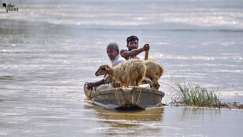
ওয়ে টু বরাক, ১২ আগস্ট : অসমে জুলাইয়ের ভয়াবহ বন্যার মূল কারণ ব্রহ্মপুত্রের জল উপচে পড়া নয়। প্রতিবেশী নাগাল্যান্ড ও অরুণাচল প্রদেশের পাহাড়ি এলাকায় অস্বাভাবিক বৃষ্টিপাতের ফলেই দক্ষিণ তীরের নদীগুলিতে আচমকা জলস্ফীতির কারণে বন্যার সৃষ্টি হয়। আসাম বিশ্ববিদ্যালয়ের গবেষকদের এক সমীক্ষা প্রতিবেদনে এই গুরুত্বপূর্ণ তথ্য উঠে এসেছে। মঙ্গলবারই ‘অসমের বন্যা – ২০২৬ : পূর্ণাঙ্গ পরিস্থিতি মূল্যায়ন ও সহনশীল পুনরুদ্ধারের পথনির্দেশ’ শীর্ষক প্রতিবেদনটি প্রকাশ করা হয়েছে।
এই প্রতিবেদন যৌথ ভাবে তৈরি করেছেন আসাম বিশ্ববিদ্যালয়ের অধ্যাপক অরুণজ্যোতি নাথ, অদিতি নাথ, অর্ণব পাল ও অনিমেষ হাজরিকা। সঙ্গে ছিলেন কলম্বোর ইন্টারন্যাশনাল ওয়াটার ম্যানেজমেন্ট ইনস্টিটিউটের সুরজিৎ ঘোষ, রাঁচির বিড়লা ইনস্টিটিউট অব টেকনোলজির স্নেহা কৌর ও অনুভা চৌধুরী এবং কলকাতার আদামাস বিশ্ববিদ্যালয়ের ঊষসী সরকার। প্রতিবেদনে বলা হয়েছে, সাম্প্রতিক দশকগুলিতে উচ্চ অসমে আঘাত হানা অন্যতম ভয়াবহ এই বন্যায় শতাধিক প্রাণহানি, প্রায় ২.১২ লক্ষ মানুষের বাস্তুচ্যুতি এবং প্রায় ২১ হাজার হেক্টর কৃষিজমি প্লাবিত হয়েছে।
প্রতিবেদনের অন্যতম গুরুত্বপূর্ণ পর্যবেক্ষণ হল, বন্যার সময় অসমে সামগ্রিকভাবে বৃষ্টির ঘাটতি ছিল। ১ জুন থেকে ২৯ জুলাই পর্যন্ত রাজ্যে স্বাভাবিক ৮৩৯.৬ মিলিমিটারের বিপরীতে বৃষ্টিপাত হয় ৫৯৪.৪ মিলিমিটার—ঘাটতি প্রায় ২৯ শতাংশ। অথচ ১৯ জুলাই নাগাল্যান্ডে স্বাভাবিকের তুলনায় ১৮১ শতাংশ বেশি বৃষ্টিপাত হয়। মোককচুং জেলায় এই অতিবৃষ্টির পরিমাণ ছিল স্বাভাবিকের তুলনায় ৪৯৩ শতাংশ বেশি। এই বিপুল জল পাহাড়ি ঢাল বেয়ে ডিকহৌ, দিশাং, জাঁজি ও ধনশিরির মতো দক্ষিণ তীরের উপনদীগুলিতে দ্রুত নেমে আসে। নদীগুলি বিপদসীমা অতিক্রম করে এবং বিভিন্ন জায়গায় পুরনো বাঁধ ভেঙে যায়। এমনকি ব্রহ্মপুত্রের মূল প্রবাহ সর্বোচ্চ জলস্তরে পৌঁছনোর আগেই উপনদীগুলিতে ভয়াবহ পরিস্থিতি তৈরি হয়। নাগাল্যান্ডের ডয়াং জলাধার থেকে জল ছাড়ার ঘটনাও ধনশিরি অববাহিকায় বন্যা পরিস্থিতিকে আরও জটিল করে তোলে।
গবেষকদের মতে, এই দুর্যোগ শুধুমাত্র অতিরিক্ত বৃষ্টির কারণে নয়। চরম বৃষ্টিপাতের পাশাপাশি মাটির অতিরিক্ত জল শোষণ ক্ষমতা হ্রাস, নাগাল্যান্ডের মোন জেলায় ধস, ধারণ ক্ষমতা পূর্ণ হওয়ায় জলাধার থেকে জল নি:সরণ, নদীতে পলি জমে তলদেশ ভরাট হওয়া, দুর্বল ও জরাজীর্ণ বাঁধ এবং জলাভূমি বিলুপ্ত হওয়ার মতো একাধিক কারণ একসঙ্গে মিলে এই ভয়াবহ রূপ নিয়েছে। তাই আগামীতে বন্যা মোকাবিলায় উপগ্রহচিত্র ও ভৌগোলিক তথ্যের সাহায্যে অঞ্চলভিত্তিক আগাম সতর্কীকরণ ব্যবস্থা গড়ে তোলার সুপারিশ করা হয়েছে। শুধু নদীর জল কতটা বাড়বে তা নয়, বন্যায় কোন এলাকা ও কত মানুষ ক্ষতিগ্রস্ত হতে পারেন—আগাম সেই তথ্য জানানোর ওপর গুরুত্ব দেওয়া হয়েছে।
এছাড়া অসমের পাঁচটি ভৌগোলিক অঞ্চলের জন্য পৃথক বন্যা ব্যবস্থাপনা কৌশল, নদীভাঙনকে সরকারি ভাবে দুর্যোগ হিসেবে স্বীকৃতি, চরাঞ্চলের মানুষের জন্য ক্ষতিপূরণ ও ত্রাণ, জলাভূমি পুনরুদ্ধার, বাঁধের আধুনিকীকরণ এবং প্রতি বর্ষার পর উপগ্রহচিত্রের সাহায্যে ক্ষয়ক্ষতি মূল্যায়নের সুপারিশ করা হয়েছে।প্রতিবেদনটির সুপারিশগুলি রাষ্ট্রসংঘের ‘সেন্দাই ফ্রেমওয়ার্ক’ ও প্রধানমন্ত্রীর দুর্যোগ ঝুঁকি হ্রাসের ১০ দফা কর্মসূচির সঙ্গে সামঞ্জস্যপূর্ণ।
Way2barak, August 12 : The devastating floods that hit Assam in July were not primarily caused by the Brahmaputra overflowing its banks. Instead, exceptionally heavy rainfall within a short period in the hilly regions of neighbouring Nagaland and Arunachal Pradesh led to sudden surges in the rivers along Assam’s southern bank, triggering widespread flooding. This significant finding has emerged from a study conducted by researchers of Assam University. The report, titled “Assam Floods 2026: Comprehensive Situation Assessment and Pathways for Resilient Recovery,” was released on Tuesday.
The report has been jointly prepared by Assam University researchers Prof. Arunjyoti Nath, Aditi Nath, Arnab Paul and Animesh Hazarika, along with Surajit Ghosh of the International Water Management Institute, Colombo; Sneha Kaur and Anubha Chowdhury of Birla Institute of Technology, Ranchi; and Ushashi Sarkar of Adamas University, Kolkata. According to the report, the floods were among the most devastating to hit Upper Assam in recent decades, claiming more than a hundred lives, displacing around 2.12 lakh people and inundating nearly 21,000 hectares of agricultural land.
One of the key observations of the report is that Assam as a whole experienced a rainfall deficit during the flood period. Between June 1 and July 29, the state received 594.4 mm of rainfall against the normal 839.6 mm, representing a deficit of nearly 29 per cent. In sharp contrast, Nagaland recorded 181 per cent excess rainfall over normal on July 19. In Mokokchung district, the excess rainfall was as high as 493 per cent above normal.
The enormous volume of water rapidly flowed down the hill slopes into southern-bank tributaries such as the Dikhow, Disang, Jhanji and Dhansiri. The rivers crossed danger levels, while old and vulnerable embankments breached at several locations. The study points out that severe flooding had already developed in several tributaries even before the Brahmaputra’s main channel reached its peak water level. The release of water from Nagaland’s Doyang Reservoir further complicated the flood situation in the Dhansiri basin.
According to the researchers, the disaster cannot be attributed to excessive rainfall alone. A combination of factors—including reduced soil water absorption capacity, landslides in Nagaland’s Mon district, reservoir releases after reaching storage capacity, silt accumulation and consequent reduction in river carrying capacity, weak and ageing embankments, and the disappearance of wetlands—contributed to the severity of the floods. The report therefore recommends developing a region-specific early warning system using satellite imagery and geographical information technologies. The emphasis, it says, should not merely be on predicting how much river levels will rise, but also on providing advance information about which areas are likely to be inundated and how many people could potentially be affected.
The study also recommends separate flood-management strategies for Assam’s five geographical regions, official recognition of riverbank erosion as a disaster, compensation and relief measures for people living in char areas, restoration of wetlands, modernisation of embankments, and post-monsoon assessment of flood damage using satellite imagery.