Barak UpdatesHappeningsBreaking News
GSI teams conduct study at landslide hit areas of Barak Valley

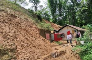
June 7: Two teams from the Geological Survey of India (GSI) conducted a survey of landslide hit areas in three districts of South Assam’s Barak Valley region following a series of landslides that claimed 21 lives on Tuesday. The GSI teams comprising two geologists each are analysing the incidence of landslips and related vulnerability in the vicinity.

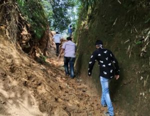
District Project Officer, District Disaster Management Authority, Hailakandi, Rupjoy Maibangsa, who assisted the team along with field officers, information assistant and AAPDA Mitra volunteers at two landslide hit areas at Mohonpur Grant under Hailakandi revenue circle and one area at Chandipur Grant under Algapur revenue circle, informed that the team of geologists carried out in depth post disaster landslide studies and vulnerability assessment at the affected sites.
 Geologist Apenthung Kikon said the teams have made preliminary studies of the geomorphology, natural drainage and slopes, soil and rock composition of the hillocks and mounds at the landslide hit areas. “The category of landslides, the dimension of the landslide, the geology, the geomorphology (study of characteristics, origin, and development of landforms) as well as what triggered them, including rainfall have been studied and assessed,” he said, adding that the report would undergo further evaluation by GSI, Assam Unit and Regional Mission Head IV, GSI, Shillong before it is finally submitted to the Assam State Disaster Management Authority (ASDMA).
 Kikon said though the causes of these landslides are mainly natural following ‘weathering of rocks eventually turning into soil and erosion of top soil due to incessant rainfall’, effect of anthropogenic (man-made) interference sometimes aggravates the situation locally at some places. In addition, the survey will add to the know-how on the relation of rainfall intensity and landslides initiation. Kikon said that the teams have sought rainfall data just preceding the landslides and on the day of the incidents from the administration of the affected districts.
 The visit of the teams from GSI is due to the prompt initiative taken by the ASDMA following series of landslides in the three districts of Barak Valley region that claimed eight lives in Hailakandi district, seven in Cachar and six in Karimganj district. Assam Chief Minister Sarbananda Sonowal during his visit to Barak Valley on Thursday to take stock of the situation in the aftermath of landslides had announced that teams from GSI would reach the Barak Valley to analyse the incidence and related vulnerability in the affected areas.
 Following the landslide incidents, the Hailakandi district administration has been shifting the people living close to hillocks and mounds to safer places. At the directive of Deputy Commissioner cum Chairman DDMA, Megh Nidhi Dahal, several teams comprising circle officers, field officers, information assistants and AAPDA Mitra volunteers have started fanning out to the landslide prone areas to evacuate the people to safer places such as educational institutions, government and private buildings. The district has 17 landslide prone spots under four revenue circles.


